The History of New Town Hemel Hempstead
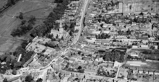
Although Hemel Hempstead is a “New Town”, the area has a past that goes back a long way. The origin of the word Hemel probably came from “Haemele”, the name of this district in the eighth century. Also suggested is that Haemele means the confluence of two rivers, which in this case would be the River Gade and the River Bulbourne.
The first recorded mention of the town is the grant of land at Hamaele by Offa, King of Essex, to the Saxon Bishop of London in AD 705. The Hemel Old Town is part of the story of historic settlement along the Gade Valley, which extends back to at least the Roman period, where there is extensive
evidence of settlement. The area also appears to be the location of an important Saxon estate centre with a possible minster church associated with a high status manorial complex at The Bury.
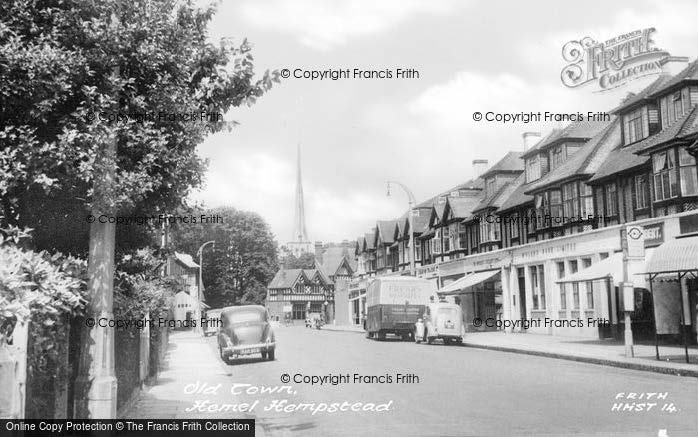
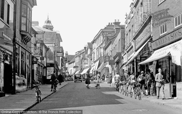
The medieval period, from which much of the present form of the Old Town is thought to date, sees planned development along the High Street with a number of long, deep plots retaining their historic boundaries from this period. The early 16th-century granting of a borough charter, together with the right to hold a weekly market and yearly fair, secured the continued development of the town to what is seen today.
After the Second World War, in 1946, the government designated Hemel Hempstead as the site of one of its proposed new towns to house the population displaced by the London Blitz, since slums and bomb sites were being cleared in London.
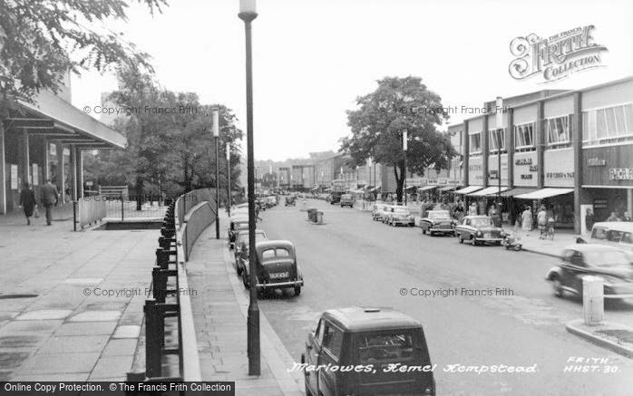
Architect Geoffrey Jellicoe drew up the initial plans for the New Town. His view of Hemel Hempstead was “not a city in a garden, but a city in a park”. Jellicoe’s original 1947 masterplan for Hemel Hempstead New Town was never to be fully implemented, rejected by the government as being too expensive and impractical. However, the structure of Jellicoe’s town centre masterplan was largely retained by the Corporation. The relocation of the main shopping area to the Marlowes, the arrangement of a central park flanked by a road running north-south, with residential housing to the
west, and shops and commerce to the east, are all key elements of Jellicoe’s Masterplan seen in the Town Centre today.
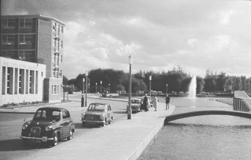
The development of the town centre started in 1952, with a new centre based on Marlowes south of the old town. This was alongside a green area called the Water Gardens, designed by Jellicoe, formed by ponding back the River Gade. By 1962, the redevelopment of the new town was largely complete, though further expansion plans were then put forward. A campus of West Herts College, the library, new police station and the Cinema were all built during the 1960s.